


 |
| Click here to see the map |
Eavesdropping all across Canada
“Walk to talk” would not be possible if there was no listening involved. Included in this challenge is the notion that if enough people are met, not only will the mandate of bringing awareness to Canadians be respected but also that people who can bring about changes will be pulled into the actions that will allow children to remain in their communities while being protected. It is a much larger than life learning curve I set for myself.Background of No Child Should Have to Take the Long Way Home
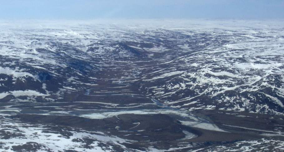
Many years after resettlements, there is still little done to make sure the children remain in their communities. My work in Nunavik allows certain conclusions that anyone can make. The known obstacles in Nunavik include the fact that there are no roads, no resident judge and that the five women’s shelters are distributed across a land the size of France. For a woman leaving her community, it is costly to leave it and even costlier when she’d like to take her children to keep them safe.An urgent need to fill the gap for the protection of the Inuit children
There is an urgent need to fill the gap for the protection of the Inuit children on their own territory and when that is not possible in their own communities.My intention to find a way to inform Canadians about the prevailing conditions of life of the Inuit children and their families is not pretentious. There were many people who did not even know anything about these first people.
If I were to define my mission, I would say that my aim is to give the Inuit people a sense of possibilities to create sustainable changes for children in their own communities.
Reclaim connections with our first people
This walk is in a manner of speaking a way to reclaim connections with our first people. Meeting individuals, groups and confronting a lens through which to look at mother-child relationships and the crucial factors that undermine parenting under difficult circumstances, it was revealing of the dominant ideology of mothering which claims to always put our children's emotional needs first, disregarding any coping responses. There is a whole chapter of our own story missing, so how can we judge?Mobilize service providers and educators to work together for the protection and safety
By increasing awareness of the situations lived by children, mothers and communities in Nunavik, it is hoped enough people of the public will mobilize service providers and educators to work together in support of a common vision for the protection and safety of the Inuit children in their own communities.This walks wants to address the prejudicial attitudes that continue to exist toward the Aboriginal people in mainstream society. Many of these attitudes are related to a lack of knowledge about Aboriginal culture and history. We cannot serve people we do not understand.
2017
ALBERTA
Setting sail again for the West at the end of April 2017, crossing the Prairies on foot, my visit to the province of Alberta seemed a miracle as grandiose as the greatest successes of my personal and professional life.
Having already travelled 2377 kilometres in BC, Ontario and Quebec in 2016, the second leg of this long journey on foot, it is easy to resume the pace of 25 to 35 kilometres per day.
Each time I have a champion-driver, we camp at night by the side of the road. I talk to other travellers. We feed on the latest victuals bought the day before. When I'm on the road, I feel physically fit, but especially in great mental shape.
It's good to take alternative walking trails where I find them before heading back for another stretch of road. It's a great adventure despite all the difficulties encountered.
When I crossed a city of any importance, I stopped to talk with the locals. I improve my English by practicing it over the endless kilometres.
The landscapes pass before my eyes: rolling meadows and golden canola fields. For a long time, I continue to see the snow-capped peaks of Alberta.
I look forward to meeting people who share Inuit-like living conditions. When I head for Lethbridge, a 163-kilometre distance from Medicine Hat, we sleep in a tent. I am told there are two Aboriginal nations in this part of Alberta, one of them is the Blackfoot.
On the way back, I promise myself I will stop in Dinosaur Provincial Park and Drumheller to visit the Royal Tyrell Museum of Paleontology. I hoped to see flocks of buffaloes. It was not meant to happen.
The identity of Albertans is closely linked to that of Aboriginal peoples. Invited by the Executive Director of the Lethbridge Friendship Center, I participate in a cultural experience by attending a local round dance. This is a local occasion where the Blackfoot people will celebrate, sing, dance and perform.
The magic of travel operates its charm. These vast expanses stimulate my thoughts. It is odd to remember that Canada's greatest women's rights activists have all lived in Alberta. To name just a few: Henrietta Muir Edwards, Nellie McClung, Louise McKinney and Emily Murphy.
In Medicine Hat, I am invited by the Friendship Center to participate in a festival of the jig, dance and music. It's amazing! The Métis are alive with their music and jigs.
SASKATCHEWAN
All provinces offer landscapes, but here my reflection turns to the history of Saskatchewan and its illustrious political leader, Louis Riel. A great defender of Métis rights (from French-speaking trappers and Native American women), he has had to cross his province many times on horseback, either to save his life or to escape the scaffold. He will be hung at Regina in 1885.
Province of the muddy badlands, the rocks here have more than 65 million prehistoric years. A real patchwork of cultures unfolds before me. The very modern T. Rex Discovery Center of Eastend and its fabulous dinosaur fossils reminds me of my eldest son’s passion for dinosaurs. By the time he made it to primary school, he had read everything about it. He knew more than all his classmates on the subject.
Although I didn’t visit the town of Floral, my father would have been proud to know that I had learned that Gordie Howe, a legendary hockey player, was born in that town of 7,700 people in Saskatchewan.
MANITOBA
The traveller who arrives by the road lined with dishevelled trees thinks she is ripe for a social day. I see the sunny skies rise into an incredible blue dome over my head and I know I have crossed the Manitoba border.
The official flower of Manitoba is the Prairie Crocus. Manitobans, jokingly, say that the mosquito is their official bird, so its lakes provide them with an ideal breeding environment. They also claim to have Louis Riel as the founder of their province. He was born in Saint-Boniface in 1844. Manitoba's long and rich history also speaks of the colonization that brought about the development of Western Canada. Its countless lakes and rivers have shaped our history and our economy. It is the heart of Canada.
The Winnipeg Art Gallery in the province's green capital exposes an impressive collection of contemporary Inuit art. The next morning, I take my first breakfast of eggs, bacon and bread in a long time. What a treat! And I am spoken to in French! My waitress comes from St. Boniface, her boss, she says, is Ukrainian. My first champion-driver in Alberta had also been Ukrainian.
I am quickly cheated out of my ambition to cross Manitoba quickly when I twist my ankle. It is only six weeks later that I will take to the road again, fresh and ready to cross the rest of the Prairies. It's August when I return. I soon have trouble recruiting champion drivers in Manitoba. No drivers, no walk! However, rain is my pet peeve, big trucks, good seconds.
The road goes straight ahead. Between wheat fields and rye fields, I measure the distance in the Prairies with its silos every 16 kilometres.
On this road devoid of the slightest asperities, I cry with joy when I see a waterhole where thousands of birds of all kinds are bathing. We are still in summer, and as the water holes are not on the side of the road, I distinguish them badly. But, according to my reading, it is the geese and ducks in the fall who frequent them.
To stimulate myself, I think I will visit every tourist information booths as I go ahead. Thus, I will relax my legs and back, stretch and continue to speak English. I seriously miss the practice.
The huge fields, the skyline that runs away from me, my feet grow weary at the end of the day and the darkness suddenly makes me realize that on these roads, some predators like bears could cross my path. I become more and more cautious.
ONTARIO
Luckily, there is a little rain while I cross into Ontario. I stop awhile to rest. The longest province to cross, I step back in time to imagine these long road ribbons occupied by carts and carriages led by his first pioneers. It is at that time a dusty and improvised road through fields and forests.
Kenora seems to be the ultimate destination for a stop at the municipal library and to give news to my loved ones on the Internet. I am not here to be a tourist but I recognize this wild setting as a vast universe of peace and solitude.
Dryden is the second-largest city in the Kenora District of Northwestern Ontario, Canada. It is the smallest community (7,749 population) in Ontario, designated as a city.
Wetlands are home to a wide variety of wildlife including red foxes, great blue herons, frogs and insects and more. Lake First Nation holds one of the largest Pow Wows in the Northwest Ontario.
The multicultural city of Thunder Bay is the 6th most culturally diverse community of its size in North America. Thunder Bay was named the Forest Capital of Canada in 2000and has existed for a 100-years. The city sits along Lake Superior and is considered the bridge between the Prairies of Canada and the Atlantic Ocean. Interestingly, Tanya Talaga’s latest book “The Seven Fallen Feathers” relates how seven Indigenous high school students died in Thunder Bay, Ontario when forced to leave home to continue their education. The seven were hundreds of miles away from their families, five of them were found dead in the rivers surrounding Lake Superior.
This feels like an expedition and I dream of crossing the innumerable lakes and streams by kayak. The fuzzy dream awakens me when I realize I do not have wrists strong and reliable enough to kayak. In another life maybe!
It would seem I could come back as a coureur des bois like some of my ancestors. The rocks of Ontario call me, they are beautiful. Mineral aggregates, especially when they are not heterogeneous captivate me.
Useful thinking is one that generates an action. For this reason, I record everything, either on my phone or on my go-pro. Because of the constraints imposed by Facebook, I choose the places that seem favourable for me to do so. These huge spaces are enchanting. The sky has never seemed so close to me. The light is that of postcards. It looks like the road has no end. I am enchanted.
It would be nice to linger in this corner of Canada, but for the moment, I cannot wait to get to Quebec. Travelling alone is full of surprises I have time to think and reflect on these thoughts. I share my ideas with cyclists and other people of my age who have a taste for travelling. My car is impressive. I have baptized my car to have a closer connection with her. Her name is DAUPHINE. Nice, my nomadic life enchants me even if it’s not always easy.
2016
In action from Prince Rupert
My plan-walking for No Child Should Have to Take the Long Way Home-was first put in action on April 9th, 2016 in Prince Rupert, a northern BC community.BRITISH COLUMBIA
Northern British Columbia offers stunning scenery and limitless outdoor adventure recreation. Speckled with countless rivers and streams, the landscape is adorned by unspoiled wildlife and is framed by picturesque backdrops. Lofty snow-capped mountains and deep plunging valleys in Northern British Columbia will surround travellers and true nature trekking enthusiasts.Prince Rupert
Prince Rupert is located on Kaien Island, just off the northwest coast of BC and at the western end of Yellowhead Highway 16, s roughly 48 km (30 mi) south of Alaska, 145 km (90 mi) west of Terrace, and 725 km (450 mi) west of Prince George. http://www.travel-british-columbia.com/north-bc/At the turn of the 20th century, it was only in the imagination of Charles Hayes, manager of the Grand Trunk Pacific Railway, that Prince Rupert existed. When he died with the sinking of the SS Titanic, the GTPR carried out his intention to build a port to rival Vancouver.
This rugged, largely uninhabited island bordered by a natural harbour was expected to be successful because it was relatively close to the Far East than Vancouver. A major Canadian seaport, it is at the southernmost part of the Alaska Ferry System. Cruise ships en route to coastal glaciers and fjords stop at Prince Rupert’s harbour.
Also said to be the world’s largest nature ice-free deep-sea harbour, this northern coast was home to the Tsimpsean and Haida cultures, whose ancestors inhabited the area for almost 5000 years. Both cultures are renowned for their stylized artworks. The Museum of Northern British Columbia shows maps, models, graphic displays and an ethnological collection to explain pioneer lifestyles of coastal groups from prehistoric times through their contacts with Europeans.
Initially, the British and Americans set up posts to trade sea otter pelts. Plentiful wild salmon, which have sustained the Tsimshian for some 10,000 years, drew dozens of canneries to the coast during the 1800s, along with a multi-cultural, seasonal workforce. In the early 1900s, the Grand Trunk Railway selected Kaien Island as its Pacific terminus, and the City of Prince Rupert was incorporated in 1910.
Trunk Railway selected Kaien Island as its Pacific terminus, and the City of Prince Rupert was incorporated in 1910.
Prince Rupert earned a place on the world map as the world's halibut capital, and during WWII, as the staging area for Allied troops and munitions on their way to the Aleutian Islands. In the post-war era, the city's fortunes have primarily been tied to fishing and forestry.
Starting in Prince Rupert allowed me to connect with people I already knew from a previous extended visit.
Vanderhoof and Fort Fraser
Vanderhoof
The name, derived from the Dakelh of the vast Athapaskan tribe (carrier-on-the-sand) refers to the sandy soil on which the community is built. Saik’uz First Nations is a Dakelh community. The Saik’uz First Nation has its main office located on the Saik’uz Reserve located south of Vanderhoof.When the last spike of the railroad was driven in the ground in 1914, the Grand Trunk Pacific Development Company offered land sale. A railroad employee, Herbert Vanderhoof, made the decision to put a new settlement in the wilderness. But this site was flooded every spring and the townspeople moved to higher ground on the opposite side of the tracks.
Fort Fraser is an unincorporated community of about 500 people: it is situated near the base of Fraser Mountain, close to the village municipality of Fraser Lake and the Nechako River. It can be found near the geographical centre of British Columbia, Canada, 44 km (27 mi) west of Vanderhoof on the Yellowhead Highway.
Originally established in 1806 as a North West Company fur trading post by the explorer Simon Fraser, it is one of present-day British Columbia's oldest permanent European-founded settlements. The area around Fort Fraser is also recorded as the site of the first land in British Columbia cultivated by non-First Nations people. Today, Fort Fraser is an active community sustained by both forestry and tourism. (Wikipedia)
Prince George
The gold rush brought prospectors to the heart of the Cariboo in the 1860s but it wasn’t until the 1920s when the Canadian Railway put Williams Lake on the map. Cattle ranchers and timber production are its economic mainstay.Several reserves are members of the Shuswap people extending from Shuswap Lake in the south to the Quesnel Lake in the North.
The Northeastern area of this land includes Prince George, the unofficial capital of northern British Columbia. Southeast is the town of McBride and an excellent starting point for exploring the stunning Robson Valley. North is Mackenzie and Hudson's Hope and the amazing WAC Bennett Dam. Further east lies Fort St. John and Dawson Creek.
Squamish
Squamish is a community and a district municipality in the Canadian province of British Columbia, located at the north end of Howe Sound on the Sea to Sky Highway.The population of the Squamish including First Nation reserves of the Squamish Nation not governed by the municipality is 15,256. For thousands of years, the Squamish Nations lived in semi-permanent villages in the winter and moved around on the land to follow fish and game in the summer. Families are deeply important to them as they honour their elders and treasure their children. The Squamish nation, vibrant and dynamic, belongs to the Coast Salish people.
The word Squamish derives from the name of the people which in their language is Sḵwx̱wú7mesh. The people reside primarily on a number of Indian Reserves owned and managed by the Squamish Nation in the Squamish Valley area. A few places and names in the Squamish area derive from Squamish language words and names. Ch’iyáḵmesh is the name of an old village that was located on the Cheakamus River. St’á7mes is a community located near the south entrance to the town of Squamish, which lies below the Stawamus Chief, which gets its name from that village. Mámx̱wem is where the Mamquam River name comes from as well.
The town of Squamish had its beginning during the construction of the Pacific Great Eastern Railway in the 1910s. Forestry has traditionally been the main industry in the area, and the town's largest employer was the Western Forest Products pulp mill and logging operation, now having permanently ceased operation on January 26, 2006.
In recent years, Squamish has become popular with Vancouver and Whistler residents' escaping the increased cost of living in those places, both less than one hour away by highway. Tourism is an increasingly important part of the town's economy, with an emphasis on outdoor recreation.
Overshadowed by Stavamus Chief Mountain and other snow-capped peaks, Squamish got its name from an Indian word meaning “mother of the wind”.
Lilloett
Lillooet is an important location in Aboriginal history and culture and remains one of the main population centres of the St'at'imc Nation. Today it is one of the southernmost communities in North America where indigenous people form the majority. Just over 50 percent of the people in Lillooet and area are St'at'imc. First Nations communities assert the land as traditional territory since time immemorial.Lillooet was formerly called Cayoosh Flat, a community on the Fraser River, about 240 kilometres (150 mi) up the British Columbia Railway line from Vancouver, is situated at an intersection of deep gorges in the lee of the Coast Mountains. This important location of Aboriginal history and culture remains the main centre for the St’at’imc Nation. About 50% of its population belongs to that Nation.
During the gold rush of 1858-1859, on this tortuous canyon brink road, a cairn was erected to commemorate the fact of the numbered roadhouse along Mount Currie. Just after this gold rush, the town's layout as it is today was surveyed by the Royal Engineers and its Main Street tied into the original Cariboo Wagon Road or Old Cariboo Road to Fort Alexandria, a huge project undertaken as a toll road by Gustavus Blin Wright, one of the many entrepreneurial personalities of the early colony. The route via the lakes to Lillooet was outflanked within a few years by the now-better-known Cariboo Wagon Road via a shorter and less portage-intensive route from Yale to Barkerville via Ashcroft a few years later.
Lillooeters still, however, consider their town to be "Mile 0" of the original Cariboo Wagon Road. The first stretch of Main Street north from the cairn is said to point due north and at one time was called "the Golden Mile" partly because of all the gold dust reputed to be scattered along it in its heyday, and also because it was the hub of supply for the surrounding goldfields.
Since it was at the end of the Lillooet Trail, aka the Douglas Road or Lakes Route, and the Lil'wat native people farther southwest along that route spoke the same language as the native bands near town, the governor was petitioned to change the name to Lillooet, with permission for use of the name granted by the chiefs of the Lower St'at'imc at Mount Currie (Lil'wat) and agreed to by the bands of what is now the Upper St'at'imc. Its incorporation dates back to 1860.
Renowned for its jade, wine is also an emerging new industry.
The Island of Vancouver
A most beautiful spot, the Island of Vancouver is sometimes described as “Canada’s Hawaii”.
Vancouver Island still has vast wilderness areas where nature can exist largely undisturbed by the interference of the humankind.
Native tribes have inhabited have inhabited the Island of Vancouver for more than 12,000 years. Each of the three distinct First Nations has a specific language. The Salish people (central and southeastern shores), Kwakwaka’wakw (northeast coast) and the Nuu Cha Nulth (west coast). One of the most compelling sights on the Island of Vancouver is the totems poles. These can be seen as monuments documenting a clan or a family’s history. They officiate also as gatepost to the traditional village entrance.
Victoria
The capital of British Columbia remains essentially British.: tearooms, double-decker buses, shops that sell china and woollens, Victoria claims a much older culture with totem poles in local parks, reflecting the city’s dual heritage.
Emily Carr, a Native of Victoria, spent her artistic career to capturing the vanishing Indigenous civilizations of the Pacific Coast.
Hippy communes in the 60s and early 70s sprang up during the free-love hippie era. 2016 will be remembered for its “tent city” next to the courthouse as Victoria was the stage for a demonstration looking like a tragic scene out of a Charles Dickens novel. “The tent city on the lawns of the courthouse has spurred a shift in the province’s thinking about homelessness in the region”, says Victoria Mayor Lisa Helps.
Victoria’s mild climate and proximity to the Pacific Ocean provide its citizens with an opportunity for an active lifestyle.
The city is endowed with many of nature’s blessings and its ample charm speaks the land’s wonder.
The city’s innumerable flower beds, hanging baskets and gardens that bloom year-round, call for everyone’s admiration.
Duncan
Along the banks of the Cowichan River is a 30-kilometre-trail that provides a number of campsites with varying levels of facilities. The Cowichan River is one of the most scenic spots on the coast.
Duncan started as a train stop. The farmer William Duncan gave his land for the original townsite previously founded as Alderlea in 1887. The growth of the logging and farming industries brought an increasing number of settlers attracted by the promise of copper and coal.
More than 80 totems make Duncan a historical must-visit town. The townsite is a living history museum (City of Totems) and a gallery is dedicated to the preservation and dissemination of the culture of the Northwest Coast Indians.
The Cowichan Valley includes other interesting communities to visit: Shawnigan Lake, Lake Cowichan, Youbou, Honeymoon Bay, Crofton, Cobble Hill.
Chemainus
Chemainus used to be a lumber and manufacturing town. Begun by local artists supported by founder and CEO, Karl Schutz, Chemainus added tourism to its economy with the creation of wonderful murals portraying the history of the Chemainus valley. These now attract thousands of tourists each year.
Nanaimo
This Hudson’s Bay Company outpost was established for coal miners coming from England and Scotland. A thriving forest and marine products industry eventually replaced the coal’s influence.
Today, the economy of Nanaimo is centred around technology, service, manufacturing, tourism and recreation. Nanaimo’s natural harbour, now surrounded by a 4-kilometre walkway along its seawall, graces Nanaimo’s waterfront.
Courtenay
In the late 1860s, when settlers began a major farming community near the Comox Valley, this town was quite popular. It has now become the terminus of the Powell River Ferry which makes round-trip excursion to the mainland.
The Kitty Coleman Woodland Gardens showcases more than 3000 varieties of rhododendrons throughout its landscape.
This nice, walkable urban centre boasts four bridges in the heart of its downtown core.
First Nations occupied this area for at least 4000 years before the settlers came in. They now operate a number of welcoming enterprises including a Potlatch Seafoods, a forestry company and the Nim Nim Interpretive Centre.
Tofino
Tofino was named in 1909 after a Spanish Naval Officer Captain Vincente Tofino whose ship had sailed past the area in 1782.
A fishing port and a resort village, its sandy beaches and Tofino’s beautiful shoreline and waters are popular with scuba divers and beachcombers, whale watchers and fishermen.
Resource-based industries such as aquaculture and logging are still present and form part of Tofino's identity. Industry in Tofino is constantly adapting to the increased demand for sustainable and environmentally sensitive practices. Tofino is popular for fishing, kayaking, whale-watching, bear-watching, bird-watching, camping, hiking, storm-watching and First Nations cultural touring.
Tofino’s botanical gardens stand on a 12-acre site: a children’s garden, a medicinal herb garden amid wood sculptures that evoke myths and fairies. It also boasts 1000-year-old cedar trees as well as an orchard and a berry patch.
Tofino is now largely for the tourist trade and has become the launch point for adventures as it draws sun worshippers, surfers and kayakers from all over the world.
Port Alberni
This once lumber boomtown is now shifting its working life towards tourism. Sports fishing attracts many visitors and the city is the gateway to the wilderness of the Island’s west coast.
The area is the traditional territory of the Tseshaht and Hupasasath First Nations, both part of the Nuu Chah Nulth Nations. Their various commercial and social facilities and programs are a significant element of the west coast cultural and economic life.
Crossing the Prairies was a bigger challenge than planned for
To change something, build a new model that makes the existing model obsolete.”
― R. Buckminster Fuller
I start this with the words of the Honourable Carolyn Bennett’s words:
‘’Children are our future, and to give them the best possible start in life, we must collectively move from an intervention-based approach of apprehension and protection to prevention-based approaches to community, families and children's rights and well-being. Working in genuine partnership with First Nations is critical to developing community-led solutions for reform that will reduce the number of children in care and result in better health, education and economic outcomes.” (date)
“Canada is committed and working to improving services provided to First Nations children and families through reform of the First Nations Child and Family Services Program. While we have made progress with partners over the past year, the next step must be a review of the child welfare component of the 1965 Agreement. Children are our future, and to give them the best possible start in life, we must collectively move from an intervention-based approach of apprehension and protection to prevention-based approaches to community, families and children's rights and well-being. Working in genuine partnership with First Nations is critical to developing community-led solutions for reform that will reduce the number of children in care and result in better health, education and economic outcomes.” (date)
The Honourable Carolyn Bennett, M.D., P.C., M.P.
Minister of Indigenous and Northern Affairs
The plan for the next lap as of April 2017 was to start in Alberta and at least, to get through the Prairies. Little did I know what a challenge that would be.
Drawing on what I have learned of the traditional culture of First Nations and Inuit in the previous part of the walk, through BC, parts of Ontario and parts of Quebec, I knew the Inuit women’s plan was to work with their men, not against them. So, I planned to question the current state of that aspect. This would include: looking at men healing themselves; identify possible barriers to healing themselves; informal meetings with groups of men is a good way to start to learn about community approaches to solve the men’s problems; meetings with research people who explore how to get men involved in curbing violence.
The work I set myself to do requires that I share my work as an activist as I go along to get media attention in all provinces. Getting more media support to educate a wider audience benefits the project and points to the importance of its goals. Sharing of my work as an activist also breaks down resistance, In this instance, introducing the Inuit is educational. Education is a major key to obtain consensus by considering all perspectives of such work across Canada. I view this work as building partnerships across Canada. It is vital. The Inuit are a vulnerable population due to their isolation and their conditions of life.
At each lap of the walk, I produce a report that is sent to my sponsors and other organizations across Canada to promote partnerships and interest in my project.
Gaining political support is one aspect of this project. I started by reaching out to mayors, across Canada. First, they are a good source of information to learn about their interests and sense of responsibilities with regard to First Nations and Inuit. I also learn about government policies which might support the project No Child Should Take the Long Way Home, i.e child care, women’s poverty or any program that affects life in communities. The other objective is to strengthen the continuity of my project.
The issues faced by the Inuit are very similar to that of First Nations across Canada on several issues: housing, employment, health, child protection. Both Inuit and First Nations have been subjected to being displaced and to the removal of their children from their families and culture. People of both Inuit and First Nations struggle with hopelessness, violence and poverty. Few members of either First Nations or Inuit are represented in positions of power, so whatever new policy created is not inclusive.
Given their history, it is hard for both nations to move on. The dominant culture’s lack of knowledge and education about issues that Indigenous people face give rise to stereotypes not easily broken. Medias constructions of Inuit who travel south often represent them in conflict with the law, who are violent or involved in sex work. That shapes the public’s view of Inuit men and women and the dangers posed by such behaviours
.
So, instead of complaining about injustice and poverty, about the stakes at hand, I left home to walk across the Prairies and to seek out ways that would make the Inuit lives better.
Mostly, I was impressed by the kindness and liveliness of the people I met across the Prairies. In most communities, I felt nurtured. Most communities visited had incredible enthusiasm and desire to know about the Inuit. As a person talking about the Inuit, I felt a strong sense of connection and belonging. Many taught me new things and gave, even more, meaning to my journey.
All through BC, I acknowledged two shared issues: racism and discrimination based on autochthony. Even I was subjected to discrimination (Alberta, motorcycles)
I think it important to create understanding about our First People and their history. They were here first, and they have a vast experience to share with us.
Second lap’s goals
No one dictated those goals. I was self-driven and hoped to answer some of my own questions. But it was also hoped I would meet with people who had tried new things and had succeeded to curb violence, to raise hope of being able to do it,Upon reading Saturviit’s report and listened to the CD given by Pascale Laneuville on the subject of women facing violence in their Nunavik communities, I heard the women saying they wanted to work with the men as they too are victims of colonialism.
I was in Ponoka, AB, when I had the first occasion to speak to a man about the situation of men. His testimony as a white man who had to confront his own violence brought me back to the faith in a higher power. As we spoke, he told me about an organization in the neighbouring town of Spruce Grove called I Have a Chance (http://www.ihacss.com). I spoke to a member of their intervention team of this organization in early May 2017. I am told they give shelter and have detox programs for the Inuit men of Nunavut.
Funding is an important part of any effort. There is a growing body of evidence that men are less inclined to seek the help of any kind from social services. In the past, the focus of men has been about bringing food on the table.
2017
2018
Ontario's route is punctuated by deep valleys, picturesque waterfalls and steep hillsides. Ontario means "splendid lake". Thousands of lakes and rivers flow through Ontario. After crossing the Canadian Shield with its spruce and pines about 9000 years after the settlements of the Paleo Indians (pictographs in support), I crossed the Sleeping Giant on the Ontario side.
Lake Superior is a cold and tumultuous lake. The human history is evident with its mining camps and its Indian pictographs throughout this part of Ontario. The section of Rossport to Terrace Bay is one of the most scenic route along Lake Superior. The largest freshwater lake of the Great Lakes, the coast seems to be inhabited by its illustrious inhabitants, the Ojibway. Their spiritual sites are now more difficult to identify.
In a country whose history is connected to the railways, the landscapes of Algoma County are impressive. The wild, rustic appearance of the boreal forest offers opportunities for any outdoors fans, fishing and hunting, as well. Loons, mergansers, great herons, eagles, ospreys are often seen on the lakes. Other travelers mentioned the appearance of bears and moose, which, thankfully, I did not see.
Throughout the territory including the coast of Georgian Bay, mention is made of the numerous visits of the "group of seven". The pink rock and the deep streaks on the rock faces invite this walker to take many pictures. On the many lakes, I imagine seeing boats of the natives of the country.
In 2018, I started walking in Rossport, Ontario. Leaving Rossport, several kilometers of paronamic scenery crisscross the landscape, particularly beautiful in the spring of 2018.
Rossport is a scattered rural community and an unincorporated place in the unorganized district of Thunder Bay District, northwestern Ontario, Canada. (Wikepedia)
Sault Ste Marie-On either side of the St Mary's River, extend the Ontario city of Sault Ste Marie and its namesake from the state of Michigan. The discovery of this place by Étienne Brûlé was furthered by Father Marquette in 1669. He founded the mission of the Jesuits in the area. The French first established an important fur trade post until the arrival of the British in 1762.
The locks connecting Lake Superior to Lake Huron are a national historic site.
Shakespeare would be proud to see the British roots of Ontario and its English heritage.
Blind River, located between Sault Ste Marie and Sudbury eastward, is so named because the Missisagi River, at the mouth of which it is located, is not visible from Lake Huron. The Northern Ontario Logging Memorial bronze monument near the Lumberjacks Village Museum is a testament to the importance of Northern Ontario's forest industry.
Elliot Lake, founded in 1954, is on the edge of a boreal forest. In full pre-Cambrian shield, this city is surrounded by one of the most beautiful wild landscapes of the region, skirting swamps, and magnificent woods.
The "firetower lookout" offers unparalleled views of Elliot Lake, Manitoulin Island and the US border. Mayor Dan Marchisella's and my cousin Richard's recommendation to visit the Lester B. Pearson Center on Route 108 was dedicated to honoring the development of the region's history when uranium deposits were discovered.
Sturgeon Falls-Back on Route 17, I take the time to visit the small town of Sturgeon Falls. Different buildings magnificently illustrate the history of the city.
Sudbury-While Sudbury owes its existence to the Canandian Pacific Railroad Company, logging is well-known to it. As a result, it became a world-renowned center for mining, smelting, refining and geology. The Dynamic Earth Museum promotes Sudbury's mining heritage.
Since 2001, Greater Sudbury is proud to have amalgamated almost all the surrounding villages: Capréol, Chelmsford, Garson, Lively, Onaping Falls and Val Caron. Grand Sudbury is home to more than 300 lakes suitable for swimming, fishing and boating.
Its theater presents professional plays, concerts and a multicultural music festival.
Current Mayor Brian Bigger presents Science North, an interactive science center, as a jewel that casts a lucid and visionary eye on the application of science to everyday life. Theatrical Theaters address a variety of topics. The theater of discovery allows scientific demonstrations. It's a must do!
North Bay, a town on the corner of Highway 11 and Highway 17, was once home to Nippissing Indians, trappers and explorers. Nowadays, lovers of the outdoors, hunting, fishing find their pleasure.
Its museum "Discovery of North Bay" presents the history of the locality. The Musée des Quintuplettes Dionne contains photographs and objects belonging to the five girls.
Deep River-This friendly village is home to the Canadian Museum of Watchmaking with over 400 clocks, watches and clock-related records from the early 1800s to present.
Chalk River is named after a tributary of the Ottawa River. Today, this village has one of the largest nuclear energy research centers in the world.
Petawawa lays claim to the Canadian Forces Base. Its museum evokes the history of the base and several military vehicles are exposed outside.
Pembroke-Located on the Ottawa River, it is the vibrant administrative city of Renfrew County in the heart of the Ottawa Valley.
Cobden-One never knows! On June 6, 1613, the explorer Samuel de Champlain lost his instrument used to measure the height of the stars from the horizon. In 1857, it is found when a boy digs and finds the instrument of 13 cm. This story is related along Highway 17.
Renfrew is located in an area of lakes, rivers and forests. Founded by Scottish settlers in the 19th century, Renfrew is a small industrial town producing machinery, telecommunications equipment, appliances and jet engine parts. As for the museum housed in a restored wheat mill, it illustrates the history of cereal products produced by the region.
Kanata-My entry into the National Capital Region of Ontario by the 50th to Gatineau in Quebec is a clean village proud of its people.
Vanier-After joining Kanata, I head for Vanier for a meeting with a group of women who tell me about their particular experiences.
Gatineau is also part of the vicinity of the National Capital Region, which is the fourth largest city in Quebec.
No comments:
Post a Comment